
Harquahala Mountains, Arizona | Camping

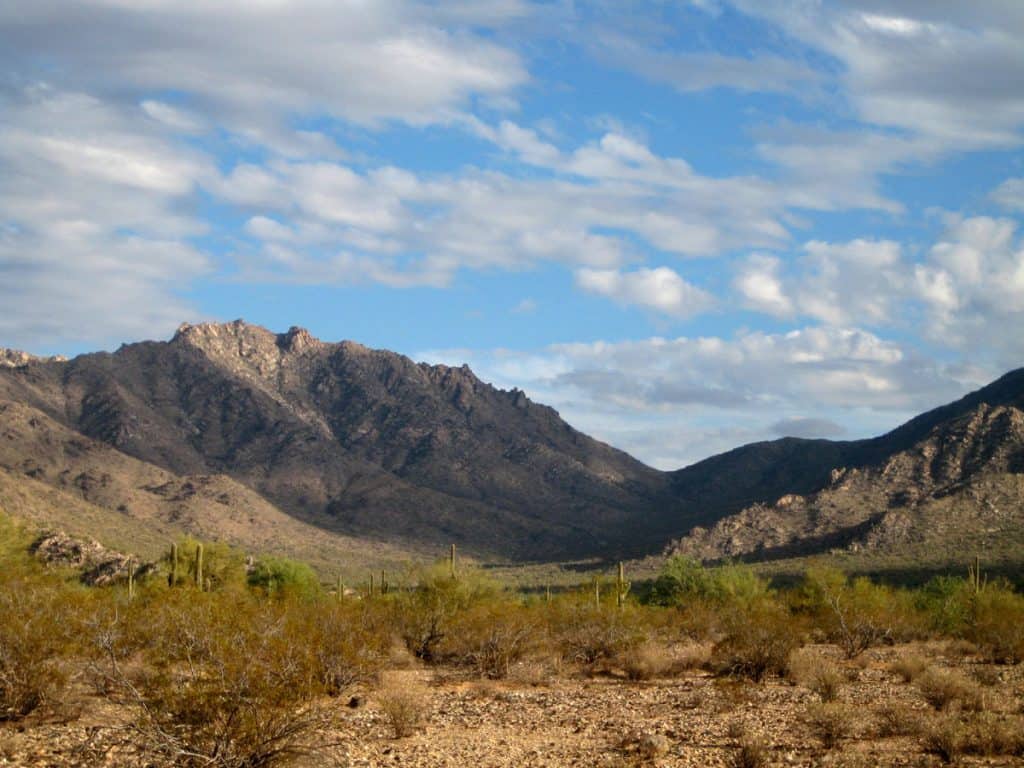
The Harquahala Mountains are the tallest mountains in southwestern Arizona. There is a 4-wheel drive road to the top, accessed from the southeast side of the mountain, and a hiking trail to the top accessed from the northwest side. Either way you reach the summit, you’ll have awesome views of the surrounding Sonoran Desert landscape.

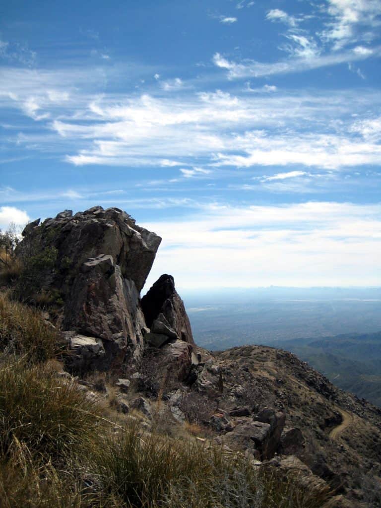
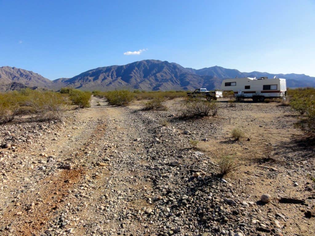
Harquahala Mountains toward Sunset Pass View from Harquahala Peak RV camping below the Harquahala Mountains Eagle Eye Road View from Harquahala Peak Hiking the Harquahala Pack Trail to the peak Harquahala Mountains from near my campsite off Eagle Eye Road The road to the top of Harquahala Mountain


We’re reader-supported. When you buy through links on our site, we may earn an affiliate commission.
Where in The World?
Harquahala Mountains South: Eagle Eye Road
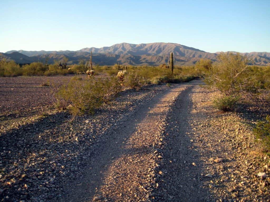
This camping area is northwest of Tonopah, Arizona and along Eagle Eye Road south of the Harquahala Mountains. There are many great sites for RV camping along the BLM roads that branch from Eagle Eye Road. The GPS coordinates and map will lead you to one good campsite south of the Harquahala Mountains near Weldon Hill.
Camping Elevation: 1,750 feet
GPS Coordinates: N 33 42.583’ W 113 18.459’
South Camping Area Map
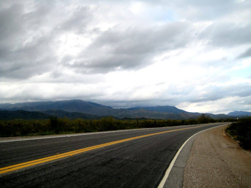
Harquahala Mountains North: Highway 60
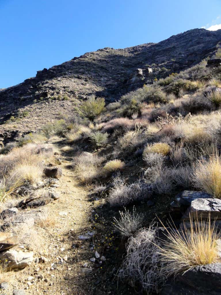
This campsite is great for exploring the north side of the Harquahala Mountains. The Harquahala Pack Trail will take you to the top of the mountain, either on foot or pack animal. There are also a few BLM roads on this side that will take you up for a better view of these rugged and beautiful mountains. RV camping on the north side of the mountains is best for small RVs with good ground clearance, as the roads are rough.
Camping Elevation: 2,120 feet
GPS Coordinates: N 33 52.533’ W 113 22.307’
Directions to Camping Area: From Wenden, Arizona drive east on Highway 60 for about 10 miles and turn right (south) on BLM Road 9331. RV camping is very limited here. I did manage to find one spot with enough room for my 25 foot fifth wheel, just off the road on the right (west) side.
North Camping Area Map
Harquahala Mountains RV Camping Journal
South, Eagle Eye Road
Day 1: February 25, 2010
I looked for a campsite today northwest of Tonopah near Big Horn Mountains Wilderness and Hummingbird Springs Wilderness. I found a spot along Eagle Eye Road just west of the wilderness areas. It is near the base of the Harquahala Mountains. Here I go, on another RV boondocking adventure!
Day 3: February 29
Weather: It was windy on the day I arrived and pretty breezy today. I had rain yesterday afternoon and last night. It was sunny today with a high in the mid 60s.
Day 7: March 4
Weather: It’s been quite nice lately; sunny with temps in the upper 60s, low 70s; breezy today.
On March 2nd I biked to the top of Harquahala Mountain. It was about 11 miles one way from where I’m camped. I left at 8 am and got back around 6 pm. It took 5 hours to get to the top (including breaks). It’s a very steep 4X4 road and I had to walk more than half the way up. There are excellent views in all directions from the summit. The road was quite busy with dirt bikes, ATVs, and SUVs. I got a great workout! I saw only 1 other mountain biker, and he was going down. I had a flat tire and had to walk the last 4 miles back to my campsite.
Day 12: March 9
This has really been a quiet and peaceful campsite. Not another vehicle has passed by this small jeep road that I have seen. It’s a pretty quiet highway too, Eagle Eye Road. It can be a bit breezy around here, but otherwise it’s a very nice spot to camp.
North, Highway 60
November 16, 2011
This has been a good campsite just north of the Harquahala Mountains. It’s wide open desert with a great view of the Harquahala Mountains and the Harcuvar Mountains to the north. It’s beautiful Sonoran Desert country, though it does take some getting used to after leaving the forests of the highlands.
It’s quiet and peaceful here much of the time; except for the traffic that I can see and hear on Hwy 60, a rather busy highway. I also hear jets quite often. It must be because I’m so close to Phoenix. Some jets can be very loud.
I wish I could find a campsite further from the highway – but these roads are rough and narrow and taking a 5th wheel trailer down them is difficult. I barely made it to this makeshift campsite. The deep ruts, due to the road being partly washed out, made the side to side articulation between the truck and trailer quite extreme. I’m not sure I’d want to try a road like this again!
Recreation: There is a great trail here to the top of Harquahala Peak called the Harquahala Pack Trail. It’s 11 miles out and back. It took about 3 1/2 hours to reach the summit. I was in the shade about half the hike (pretty much all morning) as the trail goes up the north face. The ground looked wet in several areas. It may have rained when we had cloudy weather a few days ago.
From my campsite, the base of the Harquahala Mountains can be reached in about a 1 1/2 hour hike up BLM Road 9331. I took a hike up this road and into the wilderness area until the road ended, at which point hiking became very treacherous with large boulders, bushes, and steep terrain. I did not make it to Sunset Pass as I planned.
Weather: It’s mid November. I had one good rain day last week. There have been many partly cloudy days and a few days of full sun. Highs have been in the 60s and lows in the 40s. It did get down to freezing one night last week with a high in the 50s during the day. It looks like it will warm up with highs in the low 70s for a few days. There’s usually a breeze during the day, though it’s been quite calm the last couple of days.
Wildlife: I’ve been hearing several coyotes in the evenings and on some mornings. I’ve seen a few small lizards, mainly on the mountain. There appears to be deer here, but I haven’t seen any yet. I spotted a few small birds here and there, mostly along the washes and closer to the mountain. I believe I saw several gambels quail at the base of the mountain, on both hikes. They loudly beat their wings and fly a short distance away when I approach. I saw a few eagles while hiking up the mountain.
People do hunt deer here, and I have heard shots toward the mountain. Soon after I arrived a ranger from the Arizona Game and Fish stopped by and asked if I was deer hunting.
Plant Life: It’s mostly creosote bush here. There’s also some ocotillo, palo verde trees, crucifixion thorn, and saguaro cactus. There are more varieties on the mountain and along washes.
Insects: No problem really, just a few flies.
RV Solar: It looks like it’s time to tilt my solar panel. It seems I’m just barely getting a full charge with the panel lying flat, even in cloudless weather.
Cell Signal: My Verizon cell phone signal isn’t too strong, though calls are possible while standing outside. Verizon mobile broadband internet is not very fast. I must use the external antenna, and even then it’s usually 97/108 or so – just barely “broadband”.
RV Campsite Rating: 6 out of 10. It’s a great area with access to the Harquahala Mountains, but RV camping is very limited along Hwy 60 and I’m too close to the highway! RV camping off Eagle Eye Road is a much better choice as there is less traffic and many more places to camp.


