
West Clear Creek, Camp Verde, Arizona | Camping

West Clear Creek Wilderness is truly an Arizona treasure. The creek lives up to its name with sparkling clear water. The canyon reveals brilliant red rock. This wilderness area is located in the Coconino National Forest 12 miles east of Camp Verde, Arizona.

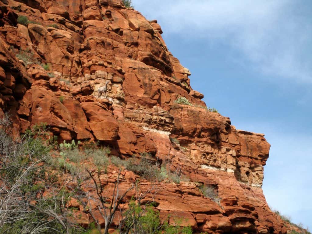
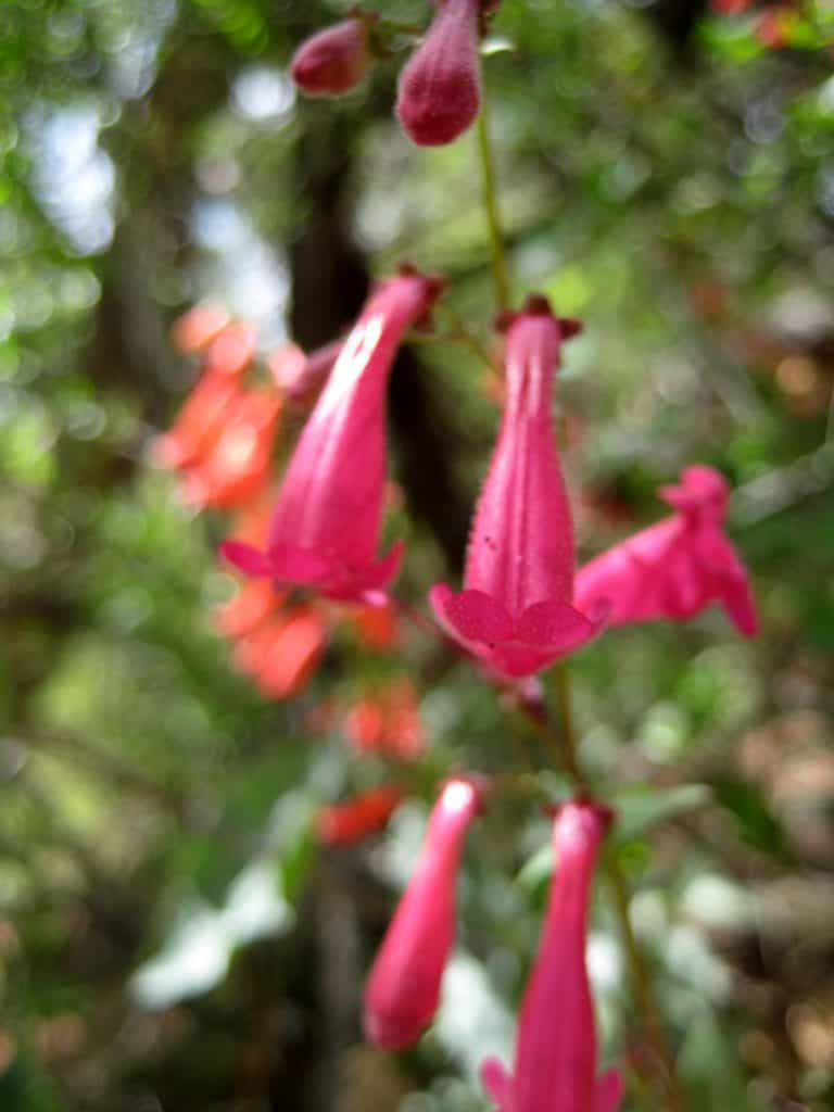
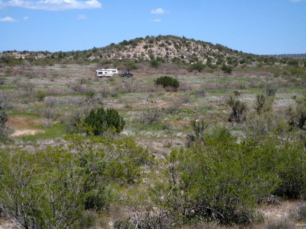
West Clear Creek along West Clear Creek Trail Bighorn sheep clinging to the colorful canyon walls Firecracker penstemon wildflowers along West Clear Creek RV camping near West Clear Creek off Bull Pen Road West Clear Creek Trail Red rock canyon walls of West Clear Creek West Clear Creek Canyon from the east end of West Clear Creek Trail West Clear Creek, Arizona RV camping near West Clear Creek in the Coconino National Forest

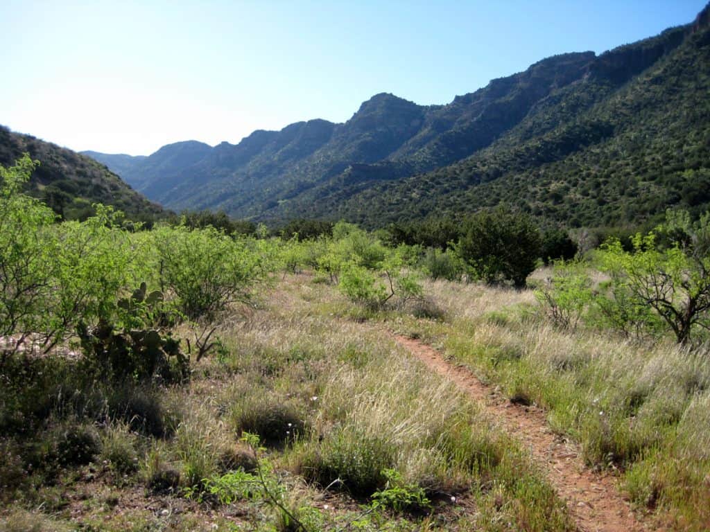

Hiking West Clear Creek Trail is a must, for its breathtaking views of this remarkable creek and canyon. On a hot day, you’ll find relief in the cool waters of West Clear Creek. The creek is perfect for wading and there are many swimming holes for those seeking a complete soak. And don’t forget your fishing pole – the creek is stocked with trout.
Lush plant life, wildflowers, and beautiful flora and fauna make West Clear Creek Wilderness a paradise for photography and wildlife viewing. Be sure to pack your camera and binoculars.
For more information, visit the official Coconino National Forest webpage: West Clear Creek Wilderness
We’re reader-supported. When you buy through links on our site, we may earn an affiliate commission.
Where in The World?
RV camping is allowed outside of West Clear Creek Wilderness in the Coconino National Forest. The best place to camp for accessing the west end of the wilderness area (and the West Clear Creek Trail) is along Bull Pen Road (FR 215). Clear Creek Campground is also an option. It is run by the Forest Service and is located just east of the small town of Clear Creek, along Highway 260.
Camping Elevation: Elevations range from 3,500 feet near the west end of the canyon up to 7,000 feet near the east end.
Bull Pen Road GPS Coordinates: 34° 32’44.5″ N 111° 45’01.4″ W
West Clear Creek Area Map
This is the location of Bull Pen Road (FR 215), which leads to dispersed campsites in the Coconino National Forest and to the hiking trails that enter the wilderness area.
West Clear Creek RV Camping Journal
May 6, 2010
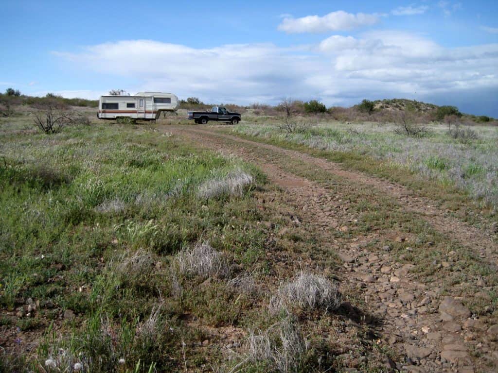
I’m camping east of Camp Verde and just west of West Clear Creek Wilderness in the Coconino National Forest. My campsite is located where Forest Road 618 and Forest Road 215 (Bull Pen Road) meet.
This is a beautiful area in mountainous terrain and a convenient spot for accessing West Clear Creek and the wilderness area. The only downside is that traffic can be heavy along Bull Pen Road, mainly Friday through Sunday, and when the weather is nice.
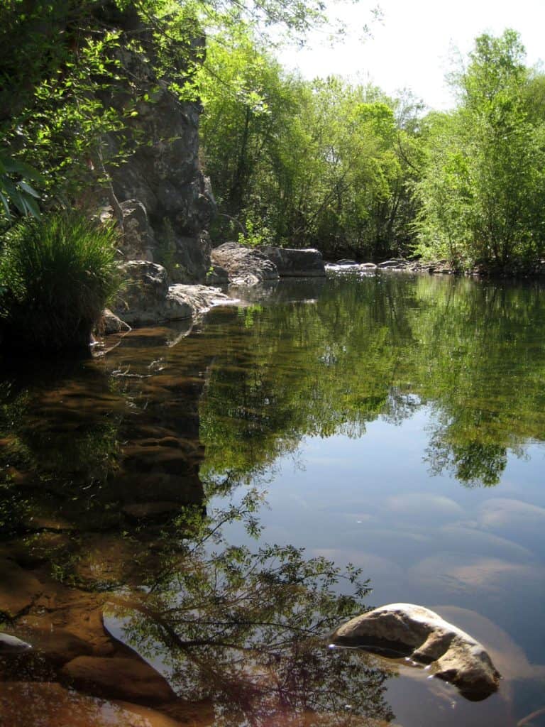
Recreation: It’s about a 30 minute bike ride to the creek from my campsite. West Clear Creek Canyon is awesome and the water looks crystal clear. I’ve only seen the wider western section so far; it’s definitely worth exploring more. The canyon gets very narrow, and I’ve heard you may have to swim through some deep pools to pass through.
West Clear Creek Trail and Blodgett Basin Trail: Yesterday I biked from my campsite to the West Clear Creek Trailhead at the end of Forest Road 215 (Bull Pen Road) and did a 10 hour loop hike. I hiked east along the creek trail (West Clear Creek Trail #17) and north following the trail up and out of the canyon to FR 214A. I then took FR 214A west to FR 214 and then took this road to the Blodgett Basin Trail which led me back down to where I started; down in the canyon and next to the creek.
It was a tough hike, mainly because of the length and because the sections going in and out of the canyon had lots of loose rock. A hiking stick or trekking pole is a good idea here.
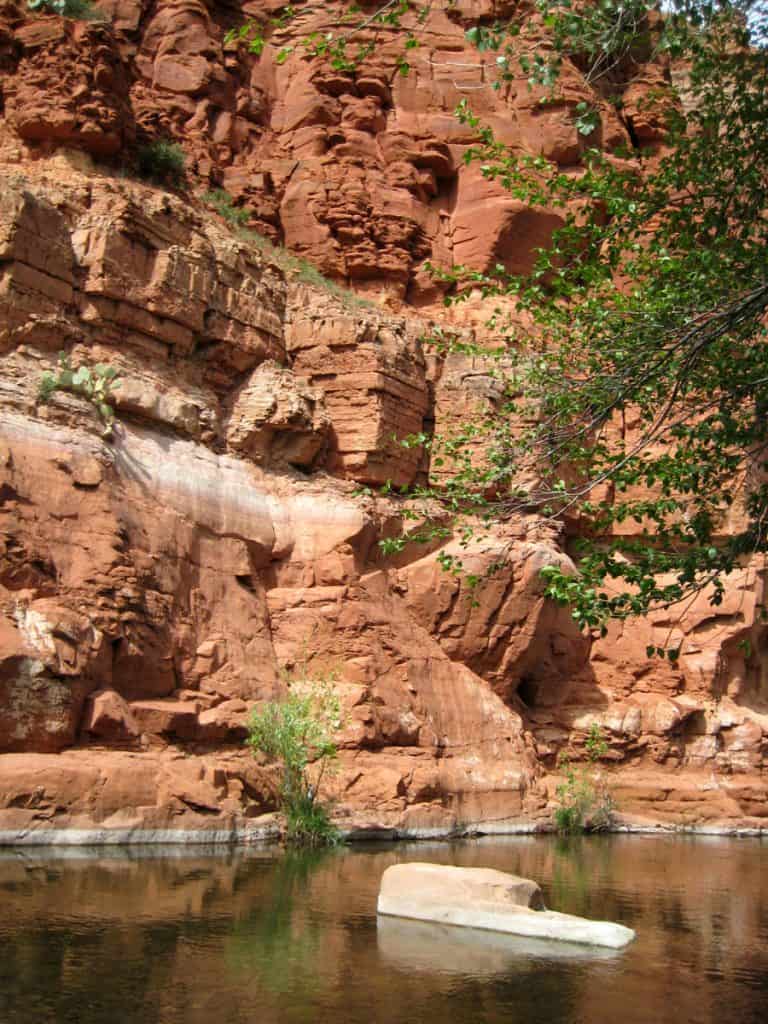
I had excellent views of the creek up close and from above, especially from the top of FR 214. Once I reached FR 214A I felt I was on top of the rim as I saw no higher mountains, and it was much more windy. It was also mostly flat. The forest is much thicker up here. There were no tall ponderosa pines, but many more trees than back at my campsite. At the eastern end of West Clear Creek Trail I could see where the canyon became noticeably more narrow; there was also much more red rock. It looks like a tough hike if one was to continue up the canyon heading east. There is no trail here, only the creek as a guide.
The hike was quite a good workout and my feet and legs were getting sore and weak near the end. It would be better to make this an overnight hike next time!
Weather: The high today (May 6) was close to 90 and it was windy and sunny. Today was the warmest day so far this year in Arizona. Yesterday was in the mid 80s, sunny, and windy in the afternoon.


